


The 2025 Boston Marathon Course Guide - Metric Edition (Kilometers & Meters)
For Boston, for Boston, thy glory is our own

Notes: This guide is based on a Run Ready Certified GPX file, created through a standardized process that combines official course maps, measurement certificates, and other plotting techniques. The official course distance is 42.16 km, which is the shortest possible route while staying within the course boundaries. The certified GPX file measures the course at 42.23 km, so distances in the guide are approximate. Additionally, and as shown below, different platforms will calculate different totals from the same set of coordinates.
This is the Metric Edition (Kilometers & Meters) of the course guide. The Imperial Edition (Feet & Miles) is available here.
Course Overview
The Boston Marathon, the world's oldest annual marathon and a bucket-list race for runners around the globe, will take place on April 21, 2025. This year's event holds special significance as it coincides with the 250th anniversary of Patriots' Day.
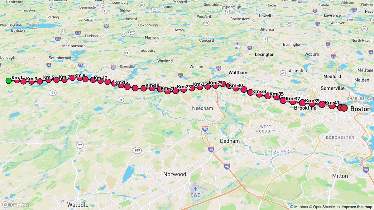
This historic point-to-point course from Hopkinton to Boston is renowned not only for its rich heritage but also for its rolling terrain, massive participant field, and the electrifying atmosphere created by thousands of spectators lining the streets.
The race features a late morning start, with Wave 1 beginning at 10:00 a.m. after the elite and para athletes have departed. Typical race day weather conditions range from 5°C to 17°C. Expect conditions around 12°C at the start line with clear skies, based on historical averages.
The Boston Marathon course is renowned for its undulating profile, featuring rolling hills and a net downhill elevation change. The course notably includes the Newton Hills around the 30 km mark, culminating in the infamous Heartbreak Hill.
Key Stats
Event Date: April 21, 2025
Event Type: Road Marathon
Course Length: 42.16 km
Course Type: Point to Point
TrailScore: 37.73
Road Marathon Difficulty Rating: Easy
Total Ascent: 246.88 m
Total Descent: 375.95 m
Longest Uphill:
Starting at KM 25.72, 1.16 km at an average grade of 1.71%
Longest Downhill:
Starting at KM 37.64, 1.33 km at an average grade of -1.67%
Steepest Uphill:
Starting at KM 28.37, 0.50 km at an average grade of 4.33%
Steepest Downhill:
Starting at KM 0.16, 0.83 km at an average grade of -5.22%
Significant Climbs (≥3% grade & ≥0.16 km):
There are a total of 6 significant climbs on the course.
Significant Descents (≤-3% grade & ≥0.16 km):
There are a total of 12 significant descents on the course.
Grade Distribution:
Flat: 50.6%
Minor Decline: 20.8%
Minor Incline: 16.5%
Moderate Decline: 7.5%
Moderate Incline: 3.1%
Challenging Incline: 0.8%
Challenging Decline: 0.8%
Course Briefing
KM 0-8 (Hopkinton & Ashland: A Fast Start)
Overview
The race begins on East Main Street in Hopkinton, featuring a significant downhill during the first kilometer that sets the stage for a potentially swift start. This section continues with rolling terrain as you transition through Hopkinton and into Ashland, primarily along Main Street and West Union Street. The course profile here is predominantly flat with a gentle decline, interspersed with short, moderate downhill stretches that encourage a faster pace in the early kilometers.
Aid stations appear frequently from the outset, providing readily available hydration. Spectator support in Hopkinton is concentrated around the starting area, while Ashland offers viewing opportunities along Main Street and near the Ashland Commuter Rail station.


Key Challenges
Controlling the Initial Downhill: The race immediately opens with a steep descent. While it's tempting to lean in and take off, maintain a controlled pace downhill to prevent early quadriceps fatigue. Focus on establishing your rhythm rather than trying to bank time in the first kilometer.
Managing Early Race Excitement: The electric atmosphere at the Hopkinton start, combined with the downhill profile and large pack of runners, can seduce runners into an unsustainable pace. Maintain discipline and adhere to your planned early race strategy, preserving energy for the marathon's later challenges.
Significant Climbs (≥3% grade & ≥0.16 km)
Climb #1: KM 0.99 to 1.15, 0.16 km, avg grade 3.51%, total gain 5.7 m
Significant Descents (≤-3% grade & ≥0.16 km)
Descent #1: KM 0.00 to 0.83, 0.83 km, avg grade -5.22%, total drop 43.1 m
Descent #2: KM 2.98 to 3.14, 0.17 km, avg grade -3.24%, total drop 5.4 m
Descent #3: KM 3.98 to 4.14, 0.17 km, avg grade -6.91%, total drop 11.6 m
Aid Stations
KM 3.2: Water & Gatorade
KM 4.8: Water & Gatorade
KM 6.4: Water & Gatorade
KM 8.0: Water & Gatorade
Points of Interest
Hopkinton Start Line: The historic starting point of the Boston Marathon since 1924.
KM 1.8: Spirit of the Marathon Statue, a tribute to the marathon's essence, located in Hopkinton.
Ashland Commuter Rail Station: A convenient access point for spectators looking to move down the course after seeing runners in Ashland.
KM 8-19 (Ashland & Natick: Settling into a Rhythm)
Overview
This section marks a transition from Ashland into Framingham and subsequently Natick, primarily along Waverly Street and West Central Street. The course maintains its rolling character, featuring a blend of flat stretches interspersed with minor inclines and declines. While you'll encounter some harder segments due to short undulations, this portion is very runnable and allows you to settle into your race rhythm.
Aid stations continue to appear frequently, ensuring consistent hydration opportunities. Spectator support intensifies as you approach Natick. Key viewing areas include the historic Framingham Train Depot, and the scenic backdrops of Natick Common and Fisk Pond, both offering enthusiastic crowd support.


Key Challenges
Subtle Energy Drain from Rolling Terrain: While lacking significant climbs, the continuous series of minor undulations can gradually sap your reserves if not approached strategically. Focus on maintaining consistent effort rather than pace on varying gradients, and avoid unnecessary surges on the subtle uphill sections.
Maintaining Disciplined Pacing: It's essential to establish your planned race rhythm in this section and resist being seduced by the cumulative downhill advantage experienced in the initial kilometers. Disciplined pacing here creates a strong foundation for the more demanding middle and later portions of the marathon.
Significant Climbs (≥3% grade & ≥0.16 km)
Climb #2: KM 12.28 to 12.44, 0.16 km, avg grade 4.02%, total gain 6.6 m
Significant Descents (≤-3% grade & ≥0.16 km)
Descent #4: KM 12.61 to 12.77, 0.16 km, avg grade -3.66%, total drop 5.9 m
Aid Stations
KM 9.7: Water & Gatorade
KM 11.3: Water & Gatorade
KM 12.9: Water & Gatorade
KM 14.5: Water & Gatorade
KM 16.1: Water & Gatorade
KM 19.3: Water & Gatorade
Points of Interest
- Framingham Train Depot: A historical landmark and a convenient spectator access point via the Commuter Rail.
- Natick Common: A central gathering point in Natick, known for its vibrant spectator support.
- Fisk Pond & Lake Cochituate: Enjoy picturesque views along the course in Natick, offering a pleasant distraction.
- KM 13.6: Henry Wilson Shoe Shop in Natick, a historical site related to the early shoe manufacturing industry in the region.
KM 19-26 (Natick to Wellesley: Approaching Halfway)
Overview
This section guides you from Natick into Wellesley, predominantly along Central Street and Washington Street. The course profile continues its rolling nature, presenting segments of mixed difficulty, yet notably lacks any significant climbs. A moderate decline around KM 25 provides a brief respite before the approaching hills. Aid stations remain readily accessible throughout.
Wellesley is renowned for its enthusiastic crowds, particularly at Wellesley College, home to the iconic "Scream Tunnel," which you'll encounter just before the halfway point. Both Natick and Wellesley offer abundant spectator zones providing considerable support.


Key Challenges
Managing Excitement Before the Halfway Point: The approach to the halfway mark and the Wellesley Scream Tunnel represents a significant emotional crescendo. Channel this energy constructively, but resist allowing the excitement to trigger an unsustainable pace increase, particularly with the Newton Hills looming ahead.
Navigating Minor Undulations: Remain attentive to the minor inclines scattered throughout this section. Maintain consistent effort rather than pace, and avoid depleting precious reserves by overreacting to these smaller elevation changes. Smooth, steady running is paramount through this rolling terrain.
Significant Descents (≤-3% grade & ≥0.16 km)
Descent #5: KM 18.91 to 19.08, 0.17 km, avg grade -3.75%, total drop 6.2 m
Descent #6: KM 20.23 to 20.40, 0.17 km, avg grade -3.64%, total drop 6.1 m
Descent #7: KM 24.89 to 25.39, 0.50 km, avg grade -5.31%, total drop 26.5 m
Aid Stations
KM 19.0: Maurten Hydrogel
KM 20.9: Water & Gatorade
KM 22.5: Water & Gatorade
KM 24.1: Water & Gatorade
KM 25.7: Water & Gatorade
Points of Interest
Wellesley College "Scream Tunnel" (approaching halfway): Prepare for an iconic experience of deafening cheers and unparalleled energy as you run past Wellesley College.
KM 23.5: Isaac Sprague Memorial Clocktower in Wellesley.
KM 24.9: Warren Park in Wellesley, a local park along the course, often a spot for community support.
KM 26-34 (Newton & Heartbreak Hill: The Toughest Section)
Overview
Entering Newton, this section marks the commencement of the Newton Hills, a defining feature of the Boston Marathon, primarily along Washington Street and Commonwealth Avenue. The terrain transforms dramatically, becoming the hardest section of the course with a series of formidable inclines and the initial climbs of the famed Newton Hills.
You will navigate multiple significant ascents in this segment, serving as a prelude to Heartbreak Hill—the most notorious climb of the course stretching from KM 32.67 to 33.33, with an average grade of 4.20% and a total elevation gain of 27.5 meters over its 0.66 km length. Aid stations remain frequent, including Maurten Hydrogel at KM 27.4. Newton is renowned for its incredibly energetic and supportive spectators, particularly along the stretch of the Newton Hills, providing crucial motivation as the course demands increasingly more from runners.


Key Challenges
Newton Hills Cumulative Effect: The succession of inclines in the Newton Hills will systematically challenge your legs and pacing strategy. Maintain a measured effort on the initial hills to preserve energy for Heartbreak Hill and the crucial remaining kilometers.
Steepest Uphill: The most severe incline of the entire course occurs within this section, just before Heartbreak Hill. Prepare both mentally and physically for this brief but intense ascent as you approach the marathon's most infamous climb.
Heartbreak Hill (KM 32.67-33.33): Heartbreak Hill stands as the iconic challenge of the Boston Marathon. While not the steepest climb on the course, its strategic late placement at KM 32.67-33.33 amplifies its difficulty. Focus on maintaining a steady, sustainable effort and draw upon mental resilience to conquer this legendary landmark.
Significant Climbs (≥3% grade & ≥0.16 km)
Climb #3: KM 26.22 to 26.39, 0.17 km, avg grade 3.73%, total gain 6.2 m
Climb #4: KM 28.37 to 28.71, 0.34 km, avg grade 5.44%, total gain 18.3 m
Climb #5: KM 31.02 to 31.19, 0.16 km, avg grade 6.21%, total gain 10.2 m
Climb #6 (Heartbreak Hill): KM 32.67 to 33.33, 0.66 km, avg grade 4.20%, total gain 27.5 m
Significant Descents (≤-3% grade & ≥0.16 km)
Descent #8: KM 26.71 to 26.88, 0.17 km, avg grade -3.08%, total drop 5.1 m
Aid Stations
KM 27.4: Maurten Hydrogel
KM 27.4: Water & Gatorade
KM 29.0: Water & Gatorade
KM 30.6: Water & Gatorade
KM 32.2: Water & Gatorade
KM 33.8: Water & Gatorade
Points of Interest.
KM 30.8: Johnny Kelley Statue on Commonwealth Avenue, commemorating a beloved Boston Marathon icon and eight-time winner.
KM 34-40 (Brookline: Post-Hills & Approaching the City)
Overview
This segment runs through Brookline, continuing along Commonwealth Avenue and then transitioning onto Beacon Street. While still featuring some rolling terrain, the most severe climbs of the Newton Hills are now behind you. However, remain vigilant of the lingering 'hard' difficulty segments and notable moderate declines.
You will encounter significant descents in this section, which can benefit your pace but demand controlled effort to prevent quadriceps fatigue during the final push. Aid stations continue to support your fueling and hydration needs. Spectator support remains substantial in Brookline, especially along Beacon Street, guiding you toward the final kilometers in Boston.


Key Challenges
Managing Late-Race Declines: Following the Newton Hills, the downhill sections may feel like welcome relief. However, focus on controlled descents. Avoid overextending your stride, which can induce muscle strain and quadriceps fatigue during these pivotal late kilometers.
Combating Mental Fatigue: This critical late stage of the marathon is where mental exhaustion can significantly impact performance. Segment the remaining distance into smaller, achievable checkpoints. Maintain unwavering focus on your race strategy, and draw strength from the intensifying crowd energy to propel yourself forward when motivation begins to diminish.
Significant Descents (≤-3% grade & ≥0.16 km)
Descent #9: KM 33.98 to 34.48, 0.49 km, avg grade -4.09%, total drop 20.2 m
Descent #10: KM 35.63 to 35.80, 0.17 km, avg grade -3.92%, total drop 6.6 m
Descent #11: KM 37.14 to 37.30, 0.17 km, avg grade -3.63%, total drop 6.1 m
Descent #12: KM 38.46 to 38.80, 0.33 km, avg grade -3.35%, total drop 11.2 m
Aid Stations
KM 34.6: Maurten Hydrogel
KM 35.4: Water & Gatorade
KM 37.0: Water & Gatorade
KM 38.6: Water & Gatorade
KM 40.2: Water & Gatorade
Points of Interest
KM 34.6: Boston College Main Campus Historic District, a landmark signifying you've conquered Heartbreak Hill.
KM 39.8: Audubon Circle on Beacon Street, a notable traffic circle and landmark in Brookline.
KM 40-42.16 (The Final Push & Boylston Street Finish)
Overview
The concluding section of the marathon unfolds entirely within Boston, culminating in the iconic finish line on Boylston Street. The terrain in these final kilometers remains predominantly flat, primarily along Beacon Street before turning onto Boylston Street for the final stretch. These closing kilometers feature overwhelming spectator enthusiasm, intensifying dramatically as you approach the finish on Boylston Street. The atmosphere becomes electric as you complete this historic marathon, achieving a goal potentially years in the making.


Key Challenges
Maintaining Running Form Under Fatigue: Even on flat terrain, the accumulated fatigue from the marathon can render this final section deceptively challenging. Consciously focus on preserving proper running mechanics—upright posture, efficient stride—to maximize economy and pace during these concluding kilometers.
Mental Fortitude for the Final Push: You've reached the final stretch! Summon your deepest reserves, harness the tremendous energy radiating from the cheering crowds, and concentrate on finishing powerfully. Visualize crossing the finish line, embrace the impending sense of achievement, and commit every remaining ounce of energy to this final effort.
Aid Stations
41.8 km: Water & Gatorade
Points of Interest
KM 40.6: Kenmore Square, a bustling landmark in Boston, signaling you are in the city center.
KM 41.6: Hereford & Boylston turn – Experience the famous final turn onto Boylston Street, a globally recognized moment in marathon running.
Boston Public Library - Central Library (near finish): A grand architectural landmark near the finish line, adding to the historic setting.
Boston Marathon Survivor Memorial (near finish): Reflect on the poignant memorial near the finish, honoring the resilience and spirit of Boston.
Boylston Street Finish Line: The culmination of your Boston Marathon journey – prepare for an unforgettable finish line experience.